Home / Hurricane Tracking

Atlantic Hurricane Tracking 2026

Pacific Coast Hurricane Tracking

Atlantic Tropical Weather Overview
Updated Sep 12, 2026 12:00 AM
Atlantic Tropical Weather Overview
Several weather waves are moving west across the tropical Atlantic. Near the west coast of Africa, showers are scattered around one such wave. In the central Caribbean, including areas east Cuba and Jamaica, there are enhanced showers and thunderstorms. Another wave is bringing rain and thunderstorms to parts of Honduras, Nicaragua, and Costa Rica. Overall, the Caribbean Sea has fresh to strong winds causing rough seas especially in the central areas, which could affect boaters and beachgoers there.
Gulf of Mexico
The Gulf region, including the Florida Peninsula, is experiencing periods of showers and storms due to abundant moisture in the air. Winds are generally gentle to moderate, with occasional fresh breezes expected near the western Yucatan Peninsula at night. Seas are mostly calm to moderate, so boating conditions are generally good with some localized gustier periods expected. These weather conditions are typical for this time of year with occasional showers and thunderstorms appearing mainly overnight.
Caribbean Sea
Strong trade winds are blowing over much of the central Caribbean, leading to choppy and rough seas, especially around Cuba, Jamaica, Hispaniola (Dominican Republic and Haiti), and nearby waters. Fresh to strong winds and scattered showers with thunderstorms are common in these areas, creating less ideal conditions for boating and beach activities. The northwest Caribbean has lighter winds but still some unsettled weather due to a low-pressure system, causing scattered showers and thunderstorms. Residents and visitors should expect breezy and occasionally stormy weather for the next several days.
Atlantic Ocean
In the Atlantic Ocean north of the Caribbean, there are some showers and thunderstorms mainly in the areas north of 25 degrees latitude between the Lesser Antilles and Bermuda. Elsewhere, the weather is generally fair with moderate winds typical of the season. Winds are moderate to fresh from the northeast near the Canary Islands and along the eastern tropical Atlantic, which could cause some choppy conditions for vessels. Overall, the seas are moderate and conditions are typical for this time of year with no significant storms expected in the near term.

Outlook


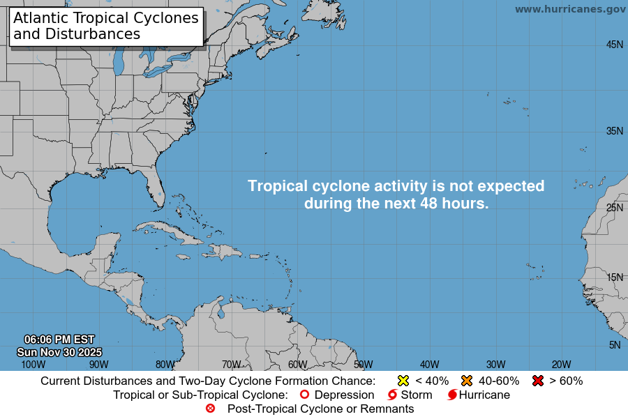
Atlantic 2-Day Graphical Outlook Image
Atlantic 7-Day Graphical Outlook Image


000
ABNT20 KNHC 112327
TWOAT

Tropical Weather Outlook
NWS National Hurricane Center Miami FL
800 PM EDT Fri Sep 11 2026

For the North Atlantic...Caribbean Sea and the Gulf of America:

Tropical cyclone formation is not expected during the next 7 days.

$$
Forecaster Kelly


NWS Local Statements

No NHC active statments at this time

NWS Public Advisories


Resources

Bookmark and Share